
Monte San Salvatore: Lugano's 912-Meter Viewpoint Above Paradiso
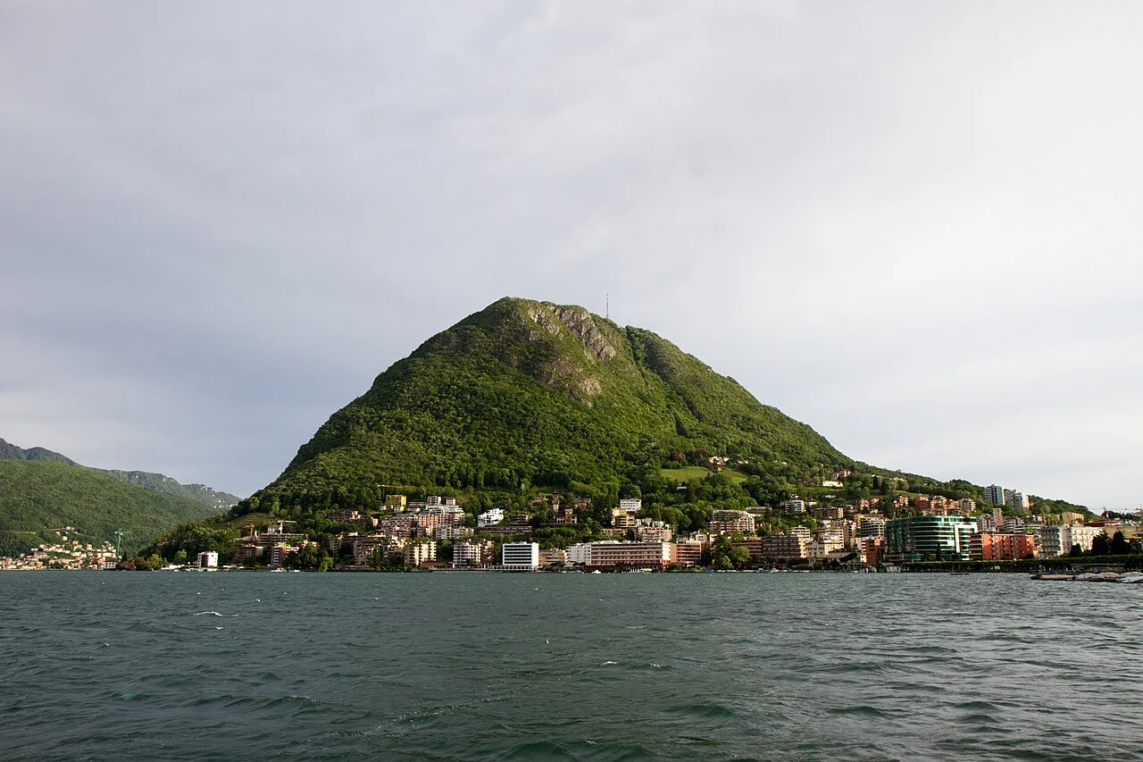
Monte San Salvatore is the rounded 912-meter mountain that closes Lugano's view to the west, and it is reachable in little more than ten minutes from the city by funicular. The climb buys a 360-degree panorama over Lake Lugano, the Ticino countryside and across to Northern Italy, which is why it earns a half day on almost any Lugano itinerary.
The practical decision is how you go up: funicular both ways for a short outing, funicular up and on foot down, or the full walk up from Paradiso and over to Morcote. Each option needs a different amount of time and a different level of fitness, and all of them start from the same lakeshore path west of the center.
Where Monte San Salvatore Sits Above Paradiso
The mountain stands just a short walk west of central Lugano, in the Paradiso district, with its top 912 meters above the lake. From the train station you head down to the lakeshore and follow the tree-lined path westward; within a few minutes you are in Paradiso at the base station of the funicular.
Because the base sits inside the city rather than out in the countryside, San Salvatore fits neatly around other Lugano sights. You can pair a morning on the mountain with an afternoon in the center, where Parco Ciani in Lugano gives you a flat lakeside walk and a view back toward the peak you just climbed. If you are still choosing where to base yourself, the Lugano Neighborhoods guide covers the areas around that same lakeshore path.
Getting to the Funicular From Lugano
The route is simple enough to do without a map: leave Lugano's station, drop down to the lake, and keep the water on your left as you walk toward Paradiso until you reach the funicular station. Trail signs marked Parco Panoramico take walkers off the road and onto the path just beyond it, so the same approach serves both modes of ascent.
Hikers who prefer to start higher can begin at Paradiso station and follow the yellow trail markers up the hill past a small palm grove, a stairway beside the funicular and a local vineyard. Viewpoints open up in the final third of the climb, which makes the upper stretch the reward for the steady work below.
The Funicular Ride
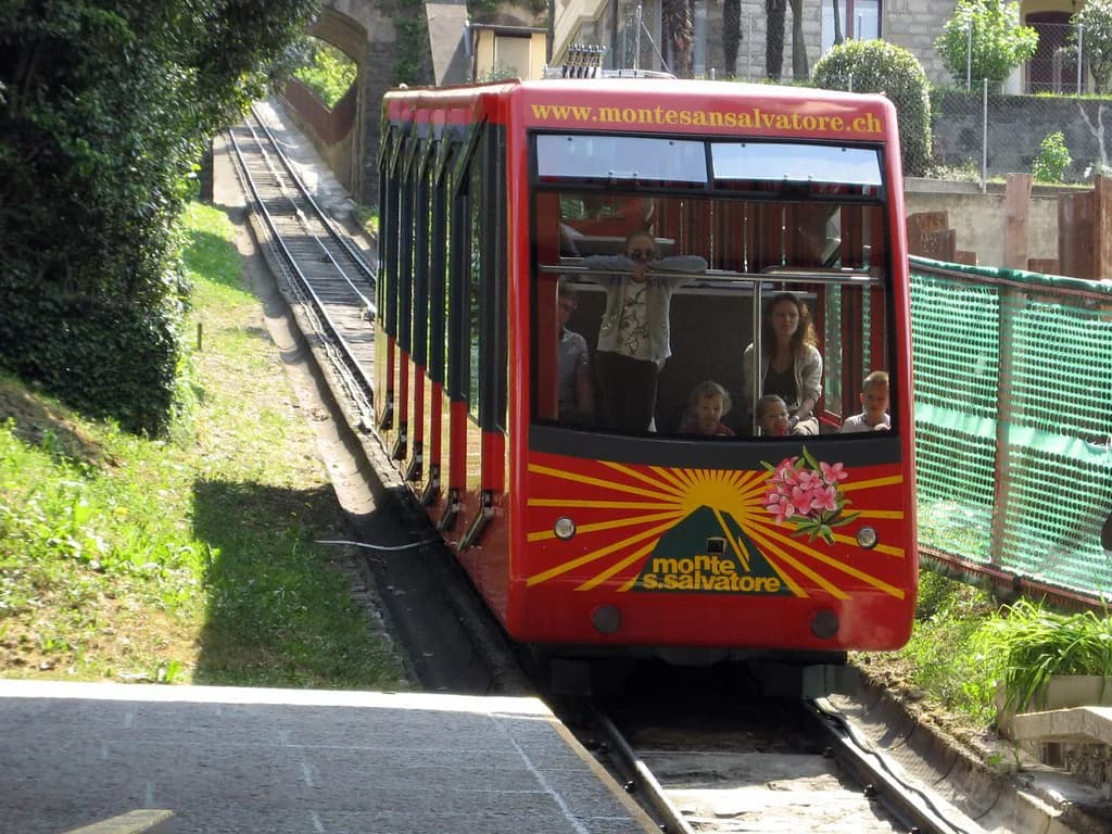
The funicular covers the climb in a little over ten minutes and runs from March to November. Trains leave the Paradiso base station roughly every half hour, which makes it easy to turn up and ride without reserving ahead.
The funicular is run by the Monte San Salvatore funicular railway, which publishes current return and one-way fares and the seasonal timetable, so check both on the day you plan to travel rather than relying on older figures. Buying a one-way ticket up and walking down is a good compromise if you want the view without committing to a full ascent on foot.
What You See From the Summit
At the top, the church has a viewing platform that most visitors make for first, and the panorama runs across Northern Italy, the Monte Rosa massif and a wide slice of Ticino. Lake Lugano lies more than 900 meters below the platform, so the view down over the water is as striking as the long sightlines. The lake looks its clearest on the sunny days covered in this guide to the best time to visit Lugano, and choosing the right season matters just as much for the city days around the mountain, as the Lugano Neighborhoods guide shows when deciding where to stay.
The roof of the chapel above the summit can be climbed for a full 360-degree view, though it does not stay open through the winter months. A small museum sits between the peak and the upper lift station and keeps seasonal hours, so treat it as a bonus rather than the reason for the trip.
A terrace next to the upper station is where most people settle once they have had their fill of the platform. If you want a second high viewpoint over the same lake on another day, Monte Brè, Lugano faces the city from the opposite side and is reached by its own cable car.

Walking Up From Paradiso
On foot from Paradiso, the climb takes a little over two hours at a steady pace. The path climbs through trees, runs parallel to the funicular for a stretch, then swings away again at the intermediate station before the final push to the summit.
A relaxed up-and-down version from Paradiso station covers about 7 kilometers with 670 meters of climbing and takes around two hours and 50 minutes. That figure assumes a very easy pace, so fit walkers will finish sooner; either way, allow more time than the pure walking figure because the viewpoints on the way up are the point.
How Much Time to Allow
A funicular round trip with time on the platform and terrace fits comfortably into two to three hours including the walk from the center. Add an hour if you want to climb the chapel roof and look through the museum, and check the last descent before you settle in for a long lunch at the top.
If you walk down instead of riding, the shortest descent back to Paradiso is about 3.5 kilometers, roughly 50 minutes on foot. The longer variant loops through Ciona, Carabbia, Pazzallo and back to Paradiso at about 6.5 kilometers, or an hour and a half, and rewards the extra distance with village lanes and a stop at Grotto San Salvatore under the chestnut trees.
The Full Traverse to Morcote
The long version links the summit with Morcote in a walk of roughly 16 kilometers and about 5.5 hours, climbing from 280 meters to 912 meters. The route is mostly easy, with a few medium or tricky sections where you need to watch your footing.
The descent from the summit is clearly signposted, and the first stretch below the top can be tricky underfoot, so slow down before the path levels out and emerges near Carona. At Carona the trail splits; take the right-hand fork signposted to Madonna d'Ongero and Torello, then take the right-hand option again at the next junction for the most direct line into Morcote.
The trail forms part of the ViaGottardo long-distance route, marked as route number 7, and the last kilometer down toward the church in Morcote is the scenic highlight of the day. Count on a full day out, with a rest stop around the halfway point in Carona, where Grotto Pan Perdu is a natural place to break the walk.
Morcote and Santa Maria del Sasso
Morcote is small but has restaurants, tourist shops and a landmark bell tower at Santa Maria del Sasso that stands out above the village. The church holds well-preserved 16th-century frescoes and has a commanding view over the lake and the rooftops below.
Reaching the church means climbing several hundred steps, which is a real decision at the end of a long descent from the summit. If your legs have had enough, the village itself and the waterfront are reason enough to finish there, and a regular ferry runs from Morcote back to Lugano, with buses stopping opposite the ferry landing.

Nearby Add-Ons Around the Mountain
Carona and Morcote are the obvious extensions of a San Salvatore day, and both sit on the southern shore of the lake. On the Melide side of the water, Swissminiatur in Melide shows Switzerland's landmarks in miniature and works well as a gentler half day if the weather turns.
Back in the city, LAC Lugano Arte e Cultura and MASI Lugano give you a cultural afternoon within walking distance of the lakeshore path you take to Paradiso. Those indoor options matter most in shoulder months, when the summit can sit in cloud while the lakefront stays clear.
Tickets, Weather and What to Wear
Buy funicular tickets at the Lugano Paradiso station or through the Monte San Salvatore funicular, and check the day's fares and departure times before setting out, since the season runs from March to November. Wear shoes with real grip for the descent below the summit, and carry a light layer for the top, which is cooler and breezier than the lakefront.
Pick a clear day rather than a fixed date if you can, because the whole point of the 912-meter summit is the view. Monte Brè, Lugano offers a second chance at a lake panorama if San Salvatore is under cloud when you are in town.
Plan Your San Salvatore Day
Choose the funicular round trip if you have half a day, the one-way walk down to Paradiso if you want exercise without a full-day commitment, and the Morcote traverse only if you can give it a whole day. Whichever you pick, start from the lakeshore path toward Paradiso and keep the trail markers in view.
Check the seasonal timetable and fares before you go, then check the weather on the morning itself. Clear skies are what make the climb worth it, and the summit platform, chapel roof and terrace all deliver the same panorama from different angles.
Explore more Lugano guides
Frequently Asked Questions
How high is Monte San Salvatore?
The summit stands 912 meters above sea level, roughly 900 meters above Lake Lugano. That height is what gives the platform its wide view over Ticino, the lake and across to Northern Italy.
How long is the funicular ride up Monte San Salvatore?
The funicular takes a little over ten minutes to reach the top, and it operates from March to November. Departures from the Paradiso base station run roughly every half hour; check the current timetable for exact times.
Can you walk up Monte San Salvatore from Lugano?
Yes. The trail starts in Paradiso, a short walk west of the center along the lakeshore, and the climb takes a little over two hours at a steady pace. A relaxed loop up and down from Paradiso station covers about 7 kilometers with 670 meters of climbing.
How long does the walk from Monte San Salvatore to Morcote take?
Allow about 5.5 hours for the roughly 16-kilometer traverse from the summit down to Morcote. The route is mostly easy with a few trickier sections, and the first stretch below the top deserves care.
What can you see from the summit of Monte San Salvatore?
The church viewing platform gives a 360-degree panorama over Lake Lugano, much of Ticino and into Northern Italy, with the Monte Rosa massif on the horizon. The chapel roof above the summit adds a full circuit of the view when it is open.
How much time should I allow for a visit?
A funicular round trip with time on the platform and terrace takes about two to three hours including the walk from central Lugano. Add time for the chapel roof and museum, or budget a full day if you plan to walk to Morcote.