Best Views in Lausanne: Where to Go for Scenery
The best views in Lausanne come from a wooden tower, a castle esplanade and a hill above the botanical gardens. Here is how to reach each one.
On this page
The best views in Lausanne come from high ground above Lake Geneva, and the city has arranged them along a single downhill route. Lausanne Tourisme maps a panoramic stroll that visits ten viewing points, from the 360-degree platform of Sauvabelin Tower down to the wooded hill of Le Crêt de Montriond. You do not have to walk the whole thing: each stop works on its own, so you can pick two or three and still see the lake, the Alps and the Jura.
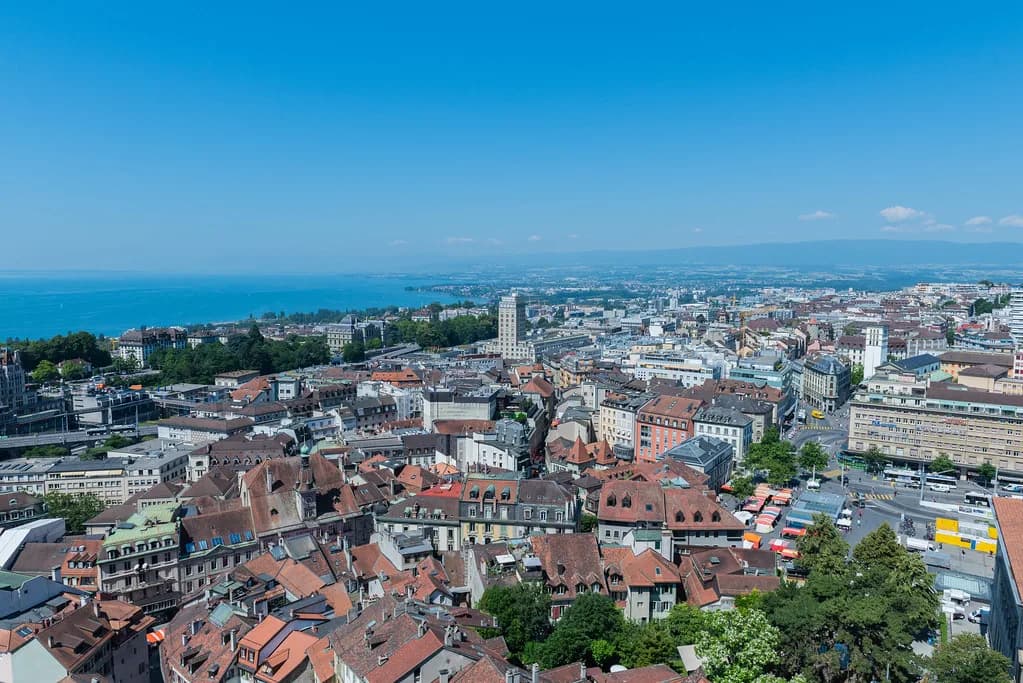
What makes the views so good is the lay of the land. Lausanne sits on a slope above Lake Geneva with the Savoy Alps across the water, so almost any terrace or park edge delivers a panorama. The city's own tourism board describes the setting this way, and it explains why viewpoints turn up in unexpected places, from a castle courtyard to a college named Belvédère after the view it commands.
Why Lausanne Has So Many Viewpoints
Lausanne faces Lake Geneva from a hillside, and the official tourism site simply says the city offers walkers a series of extensive panoramic views. The slope is steep enough that streets and parks stack up in layers, each one catching a slightly different angle on the water. That is why the best views are not confined to one lookout.
The old town sits on the Cité hillside, which was carved out over time by two now-buried rivers, the Louve and the Flon. Their erosion exposed molasse, the grey stone used to build St. Maire Castle and Lausanne Cathedral, and the same ridges that gave the city its building material also give it its terraces. Understanding that geology helps you read the city: the upper old town looks down over the lower districts and out to the lake.
If you only have a few hours, plan your viewpoints around one slope rather than crisscrossing the city. The full stretch of things to do in lausanne rewards a slower pace, but the panoramas concentrate in the arc between Sauvabelin in the north and Montriond in the south.
Sauvabelin Tower: The 35-Meter Wooden Lookout
Sauvabelin Tower is the headliner. The structure rises 35 meters and was built in 2003 from wood, principally Douglas fir from local forests, and its top platform opens a 360-degree view over the Lausanne conurbation, Lake Geneva and three geographic regions of Switzerland: the Alps, the Jura and the Plateau.
Knowing the three regions makes the climb more interesting. The Alps rise across the lake to the south, the Jura form the long ridge to the northwest, and the Plateau is the rolling midland between them. Locate all three from the platform and the panorama stops looking like a single wall of mountains.
The tourism board treats the tower as the opening stop of its panoramic stroll, and the surrounding Sauvabelin woods make a calm start before you head downhill. Switzerland's national tourism site also singles out the tower for views over the whole city and the lake.
Signal de Sauvabelin: The Lookout Below the Tower
From the tower the route follows a wide tarred forest path, turns left, drops to the right and crosses a road at a pedestrian crossing beside a bus stop before reaching the Signal de Sauvabelin lookout post. The tourism board times this leg at about 10 minutes. It is a short descent, not a hike, and it puts you in the trees rather than above them.
Treat the Signal as a bonus rather than a destination. The tower gives you the full sweep of the horizon; the lookout gives you a quieter, framed view through the forest on the way down. If your knees dislike steep downhill walking, start here and skip the tower climb.
Hermitage Park and the Fondation de l'Hermitage
Below the Signal, a grassy path crosses a meadow and an orchard to reach the Fondation de l'Hermitage, an art gallery housed in a historic mansion with a nearby outbuilding. The English gardens on the lake side of the park are worth lingering in, and the park's lawns face the Savoy Alps across the water.
One tree in Hermitage Park earns its own mention. A weeping willow stands about 50 meters southwest of the manor house and was planted when the park and outbuildings were laid out in 1855 to 1857. Lie on the grass beneath it and the Alps and Lake Geneva fill the frame, yet the town center is only a ten-minute walk away.
This is the viewpoint to choose if you want a view with a lawn, a bench and no climbing. The park's name also gives you a reason to linger indoors if the clouds drop, and museums in lausanne covers how to slot a gallery visit into the same afternoon.
St. Maire Castle Esplanade and Lausanne Cathedral
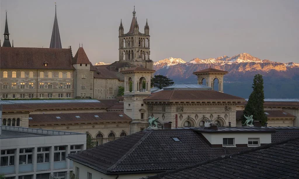
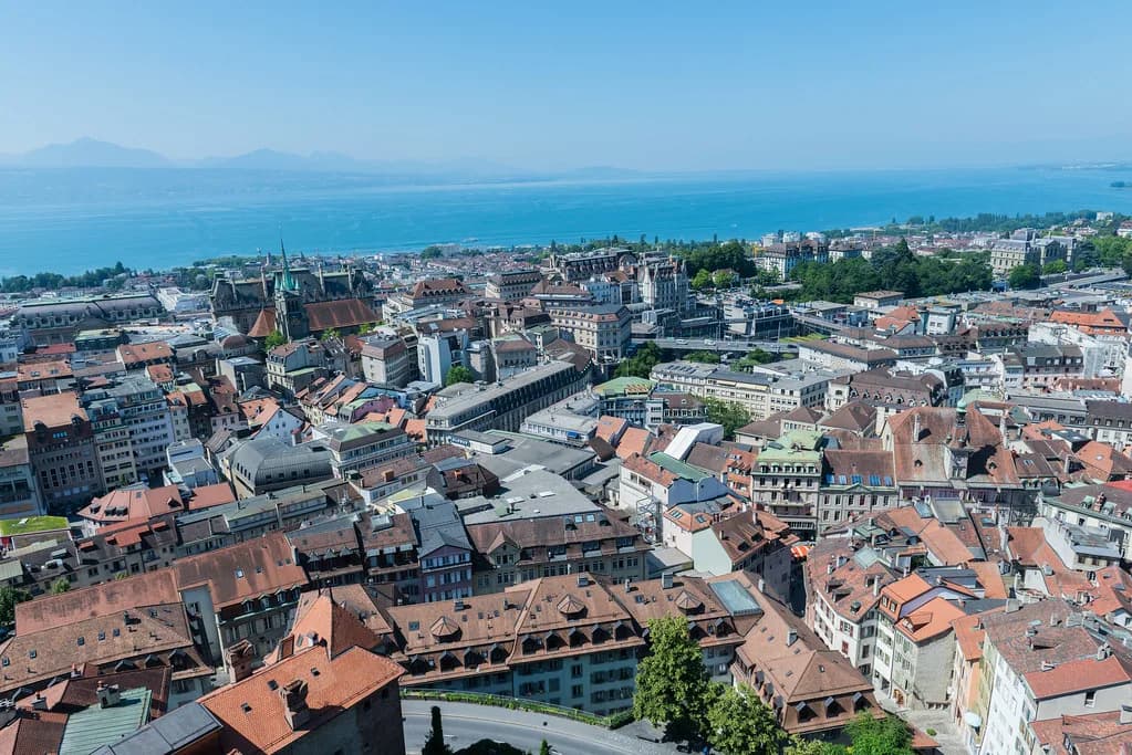
The old-town terrace above the Cité hillside is one of the most atmospheric places to look out. From the esplanade of St. Maire Castle you look across the hollow where the River Louve once ran, now buried, and then walk from the castle courtyard to the cathedral.
Lausanne Cathedral anchors this stretch, and the walk between castle and church gives you the classic old-town view over the roofs and down toward the water. Use our lausanne old town guide to place the cathedral, the castle and the surrounding lanes on one map before you climb.
Place de la Palud and the Market Stairs
From the cathedral, the market stairs begin opposite the main entrance and drop you to Place de la Palud, where you cross the square past a fountain and the city hall. The stairway itself is the viewpoint here, since it looks down over the square's roofs and the pedestrian lanes below.
Keep going straight ahead past the city hall into the pedestrian zone and the street first descends gently, then climbs to Place St-Laurent. Turn left onto Rue Pichard and follow it as it bends right to a pedestrian footbridge. The route is deliberately downhill for long stretches, so plan your start high and let gravity do the work.
Montbenon Esplanade: The Flat City Balcony
Montbenon Esplanade is one of the most beautiful balconies over the lake, and it is entirely flat for more than half a kilometer, a rarity in Lausanne. A statue of William Tell, the legendary Helvetian hero with his crossbow, stands on the esplanade just a short walk from the Church of St. Francis.
If stairs are a problem, make this your main viewpoint. You get the lake and mountain panorama without a single step, and the flat promenade is easy to combine with a wander through the old town. It is also the easiest stop to reach on a short visit.
Collège du Belvédère and the Lakeside Panorama
Near Collège du Belvédère the overview of the lake and the Alps widens as you approach, and the college on your right takes its name from exactly that sight. The route then drops along Chemin des Croix-Rouges, crosses a bridge over the railway tracks and continues on Chemin du Languedoc.
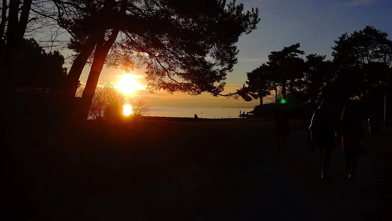
This stretch is the one that surprises people, because the view opens up in the middle of an ordinary residential quarter rather than at a formal lookout. Arrive near sunset and the lake catches the light while the Alps turn blue behind it.
Le Crêt de Montriond and the Botanical Gardens
Le Crêt de Montriond is a hill formed by an ancient glacial moraine, and its summit gives a panoramic view over Lake Geneva, the mountains and the city. Below it, Place de Milan offers a large grassy area, an ornamental lake and children's amusements, and the Cantonal Botanical Museum and gardens hold 6,000 plants from around the world on the southern hillside.
Several paths lead to the top, including one that starts at the bottom of the park and climbs through the Botanical Gardens. That makes Montriond the most rewarding end point of the official route: you finish on a wooded hill with the whole lake spread out in front of you.
Walking the Official Panoramic Stroll
The tourism board's panoramic stroll is a marked sequence rather than a single signposted trail, so follow the directions stop by stop. The order runs from Sauvabelin Tower past the Signal, through Hermitage Park, along the St. Maire esplanade to the cathedral, down the market stairs to Place de la Palud, over the Flon footbridge, along Allée Ansermet to Montbenon, then past Collège du Belvédère and the Languedoc hillside to Le Crêt de Montriond.
You can shortcut the route at several points. Take a bus to Sauvabelin for the tower, walk down to Hermitage Park, then rejoin the old town by way of the cathedral and finish at Montbenon for a flat, easy finale. That version hits the tower, the park, the terrace and the balcony in a single downhill arc.
If you want the old town in more detail between cathedral and Palud, our lausanne old town walking tour covers the lanes and squares the panoramic route passes through. Lausanne Attractions collects the individual sights along the way in one place.
Best Time of Day and Weather for Lausanne Views
Morning light comes off the lake from the east, so the Alps across the water are sharpest early. Late afternoon and evening suit the terraces above the old town, where the low sun picks out the cathedral and the castle before the valley falls into shadow.
Weather decides everything in Lausanne. The Alps and the Savoy Alps are only visible on clear days, and cloud sitting on the lake can wipe out a whole panorama while the city itself stays dry. Build a flexible plan: keep the tower and the hill for the clearest day and save the old-town terraces for when the peaks disappear.
Practical Trade-Offs and a Short-Plan Version
The official route is downhill by design, so start at Sauvabelin and finish at Montriond. Reverse it and you climb the whole way. Steep stairs link the cathedral to Place de la Palud, and the descent from the tower to the Signal involves a road crossing and uneven forest paths, so wear shoes that grip.
With time for only two stops, choose Sauvabelin Tower for the widest panorama and Montbenon Esplanade for the easiest one. Add Hermitage Park if you want a lawn and a willow tree between them. Skip the middle stops on a short visit and the views still stack up. If you want to compare how another Swiss city lays out its panoramas, our guide to the best views in basel makes a useful counterpart.
The viewpoints themselves are outdoor spaces you reach on foot, and the city's tourism site publishes the route and each stop. Prices for anything ticketed along the way belong to the individual attraction, so check the venue's own page before you go.
Plan Your Visit
Lausanne rewards travelers who plan their views as a sequence rather than a checklist. Start high at Sauvabelin Tower, work downhill through Hermitage Park and the old-town terraces, and finish on the flat expanse of Montbenon or the wooded summit of Le Crêt de Montriond. The city lays the whole route out, and you choose how much of it to walk.
Pair the panoramas with a closer look at the streets below. The old town and cathedral sit right on the route, and the museums along the way give you somewhere to wait out a cloudy hour. Build the views into your days rather than around them, and Lausanne will keep opening new angles.
Explore more Lausanne guides
Frequently Asked Questions
What are the best views in Lausanne?
The strongest panoramas come from Sauvabelin Tower, which gives a 360-degree view of the city, Lake Geneva, the Alps, the Jura and the Plateau, and from Le Crêt de Montriond, a glacial hill above the botanical gardens. Montbenon Esplanade offers a flat balcony over the lake, and Hermitage Park and the St. Maire Castle esplanade add terraces and lawns with lake views.
How tall is Sauvabelin Tower and what can you see from the top?
Sauvabelin Tower is 35 meters high and was built in 2003 from Douglas fir timber. From the top you see the Lausanne conurbation, Lake Geneva and three geographic regions of Switzerland: the Alps, the Jura and the Plateau.
Where in Lausanne can you see the Alps and Lake Geneva at the same time?
The tower platform at Sauvabelin shows both, and so do the lawns of Hermitage Park, which face the Savoy Alps across the water. Montbenon Esplanade looks over the lake, and Le Crêt de Montriond gives a panorama of the lake, the mountains and the city.
Is the Lausanne panoramic walk downhill?
Yes. The official route starts at Sauvabelin Tower above the city and descends through Hermitage Park, the old town, Montbenon and the Languedoc hillside to Le Crêt de Montriond. Walking it in the other direction turns almost the whole outing into a climb.
Do you need to pay to visit Lausanne's viewpoints?
The viewpoints on the panoramic route are outdoor spaces reached on foot. Any ticketed attraction along the way sets its own admission, so check that venue's page for current details before you plan on going inside.
How long does the Lausanne panoramic stroll take?
The route links ten viewing points across the city, and the tourism board times one leg, from Sauvabelin Tower down to the Signal de Sauvabelin, at about 10 minutes. Build in time at each stop, or walk only part of the route, since the sections can be done separately.
Which Lausanne viewpoint is easiest to reach without stairs?
Montbenon Esplanade is the low-effort choice. It is a flat stretch of more than half a kilometer overlooking the lake, with a William Tell statue and the Church of St. Francis close by. Hermitage Park is another option where the view comes from a lawn rather than a stairway.
Can you see Mont Blanc from Lausanne?
The views described from Sauvabelin Tower cover the Alps, the Jura and the Plateau, and the Savoy Alps appear from Hermitage Park and the Belvédère stretch. Mont Blanc is not named as a landmark in the city's published viewpoint descriptions, so plan around the broad alpine panorama rather than a single peak.
Sources
Notes for your Swiss city break
Optional updates to our Swiss city guides.
You might also like
Continue reading
More guides you'll find useful